
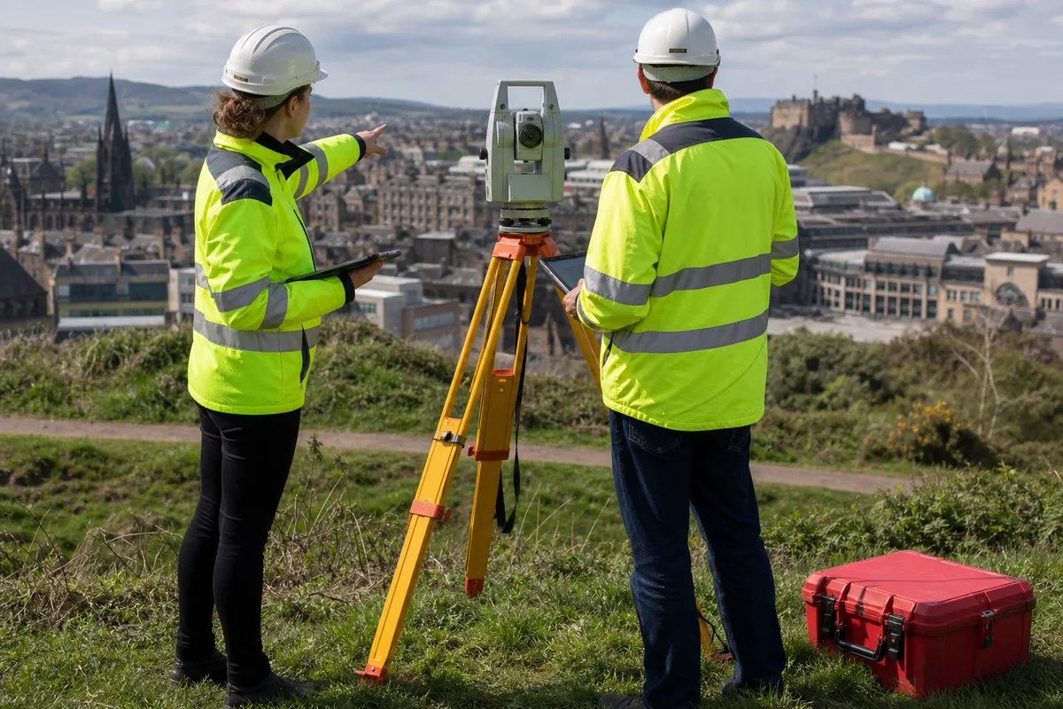
Sector pursuit field 34 · Technology and digital
Our basic working position: This is the first position we would test—not the final bid position. It changes with every buyer organisation, procurement or commercial team, evaluator group, operational user, budget owner and other stakeholder. The live opportunity, people, documents, conversations and clarifications determine the final pursuit.
Match the support to the pursuit
Start with the work the opportunity actually needs.
These are three useful routes—not a fixed package. The live documents, bidder position, deadline and buyer decision determine the final support.
Bid & Tender Writing
Turn approved geospatial data, accuracy, integration and user evidence into clear mapping-service answers.
See when to use this serviceEnd-to-End Bid Management
Control data, platform, accuracy, integration, user and mobilisation evidence across a geospatial pursuit.
See when to use this servicePolicies, Standards & Certification Readiness
Strengthen data governance, security, quality and controlled-method evidence for mapping services.
See when to use this servicePublic and private contract pursuit
Same capability. Different buying system.
A gis, geospatial and mapping services pitch cannot be carried unchanged from a published public competition into a private sourcing decision. The solution may be similar, but authority, visibility, negotiation, risk appetite and the people shaping the decision can be very different.
Follow the declared route—and the decision behind it.
Buyer settings evidenced in the sector dossier: utilities and infrastructure operators; national mapping and central-government bodies; housing, local-government and public-estate organisations.
Start with the live notice, conditions, evaluation model, timetable, clarification rules and contract.
- Separate licensed data, survey capture, analytics, software and operation before qualification.
- Confirm dataset rights, intended decision, coordinate reference, accuracy and acceptance.
Find the real buying group and approval path.
Utilities, developers, insurers and logistics businesses commission platforms, surveys, data licences and managed geospatial services.
- Establish who initiated the purchase, who owns the budget, who can veto it and how procurement, legal and finance will shape the agreement.
- Test incumbent relationships, negotiation room, approval gates, commercial risk and the evidence each decision-maker needs.
- Use conversations lawfully available in the process to refine the proposition; do not assume a private RFP reveals every deciding factor.
The “buyer” is rarely one person.
Align operational users, surveyors, data owners, IT, legal, privacy, finance and asset teams.
Sector roles to test: data owners, licensors and information-governance leads; survey, engineering, land and asset specialists; GIS, platform, integration and security teams; field workers, analysts, decision-makers and public users; legal, procurement, commercial and operational authorities.
The bidder is ready; the response needs precision.
Use focused writing when the gis, geospatial and mapping services offer, price, delivery model, responsibilities and approved evidence already withstand challenge. We then align them to the question, stakeholder, evaluation logic and response architecture without pretending prose can repair the underlying business.
Find the route. Strengthen the bidder. Run the bid.
Use end-to-end management when suitable public or private opportunities need sourcing, private-buyer invitation positioning needs strengthening, or qualification, competitor intelligence, solution design, sourcing, pricing, partners, evidence and mobilisation still need work. Bid Champions runs the workload while the client retains concise go, price, risk and commitment approvals.
Candidate lifecycle movements: Shape → Design → Prove → Deliver. Useful operating lenses to test include Zanshin (sustained operational attention), independent review and handover readiness. They are selected proportionately; they are not certification claims or a substitute for the live contract.
Explore Achmed Esser's Assurance & Delivery Lattice →Relevant practice here can include capture strategy, compliance matrices, solution and pricing alignment, colour-team reviews and implementation transition. We apply the parts that fit the pursuit rather than forcing every competition through one template.
See APMP's winning-business lifecycle →Geospatial procurement covers distinct data, survey and platform markets
Evidence-linked insight · What this changes Recent records separate a multi-method survey framework, enhancement of national geospatial content, supply of named Ordnance Survey and land-registration datasets, and renewal of an enterprise GIS subscription. These are not interchangeable services: each has different rights, skills, acceptance evidence, safety conditions and commercial drivers. [ 010, 011, 012, 013 ]
Where we would start first Classify every lot and deliverable as licensed data, field capture, remote sensing, content maintenance, spatial analysis, platform subscription, implementation, integration or managed operation. Name the boundary and interfaces. Do not use evidence from a software renewal to establish survey competence, or an award notice to imply performance. [ 005, 006, 009, 010 ]
Route and notice stage determine what can safely be inferred
Evidence-linked insight · What this changes The Procurement Act and Regulations provide the statutory setting, while the reviewed records include a utilities framework award, content framework award, below-threshold contract and subscription award. A common geospatial label does not establish procedure, eligibility, call-off mechanism, guaranteed demand or the latest contracting position. [ 001, 002, 010, 011, 012, 013 ]
Where we would start first Check authority type, regime, notice history, procedure, framework lot, supplier status, participation conditions, timetable, amendment record and complete procurement pack. Describe preliminary, tender, award and contract stages accurately. For frameworks, model the effort and uncertainty of further competitions without treating ceiling values as forecast revenue. [ 001, 002 ]
The decision use case should precede the map or platform
Evidence-linked insight · What this changes Location data can support asset planning, land management, field work, network operations, modelling and public communication. The same feature may require different precision, currency and attribution for each decision. A visually persuasive map does not show that its data is fit for engineering, ownership or safety-critical use. [ 005, 006, 009, 010 ]
Where we would start first Define the user, decision, geographic extent, scale, frequency, tolerance, consequence of error and non-geospatial fallback. Trace each dataset, capture method, transformation and display choice to that decision. State uses that are excluded, especially where the available evidence cannot support legal boundary, buried-service or operational conclusions. [ 005, 006, 009, 010 ]
Dataset access is not the same as unrestricted reuse
Evidence-linked insight · What this changes Ordnance Survey describes public-sector licensing, and Plus Dane's contract names MasterMap Topography, AddressBase Plus and HMLR land-ownership polygons. Product access, organisational entitlement, copying, derived data, contractor use, onward sharing and public display can be governed by different terms. Public availability does not prove ownership or free reuse. [ 007, 008, 012 ]
Where we would start first Create a rights register by dataset, version, licensor, licensee, purpose, territory, users, processors, derived output, publication, retention and exit. Obtain legal or licensing review where interpretation is uncertain. Price any additional licences and ensure subcontractors receive only the access needed for the authorised task. [ 007, 012 ]
Standards need a selected version and implementation profile
Evidence-linked insight · What this changes The UK Geospatial Data Standards Register helps teams discover relevant standards, but it does not make every listed standard mandatory for every dataset. Coordinate reference systems, metadata, addressing, feature classification, exchange formats and web services solve different interoperability problems and may have buyer-specific profiles. [ 006 ]
Where we would start first Build a standards matrix stating requirement, issuing body, version, mandatory status, implementation choices, validation tool and evidence. Confirm coordinate reference system and transformation method explicitly. Test a representative exchange with each consuming system rather than claiming interoperability from a format name alone. [ 006 ]
INSPIRE scope requires entity and dataset analysis
Evidence-linked insight · What this changes The INSPIRE Regulations address spatial datasets and services within their legal scope. They should not be presented as a universal specification for all mapping work or private datasets. Organisational status, dataset theme, public-task connection, service obligation and current amendments require competent interpretation. [ 004 ]
Where we would start first Record whether INSPIRE is applicable, who decided, the dataset or service in scope, required metadata or network service, publication constraints and review date. Separate statutory obligations from useful design principles. If applicability is unresolved, retain it as a legal review item rather than converting uncertainty into a compliance claim. [ 004 ]
Precise location can create personal and security risk
Evidence-linked insight · What this changes Addresses, property interests, movement traces, imagery and asset coordinates may identify people or reveal sensitive facilities when combined with other records. Data-protection obligations depend on the information and processing, while operational security can apply even where data is not personal. Greater precision and longer retention are not automatically beneficial. [ 003, 010, 012 ]
Where we would start first Map processing purposes, roles, lawful authority, minimisation, access, sharing, retention, individual-rights routes and security classification. Generalise or suppress location where the decision permits. Test re-identification and mosaic risks across layers, and document why each coordinate, image, address and history field is necessary. [ 003 ]
Survey method must match terrain, asset and required confidence
Evidence-linked insight · What this changes United Utilities' framework lists aerial LiDAR, photogrammetry, bathymetry, hydrography, underground utility surveys, GPR, mobile and terrestrial scanning, drones, measured buildings, topography and modelling. Each method has different access, calibration, visibility, environmental and interpretation limits. One survey credential cannot prove competence across the entire list. [ 010 ]
Where we would start first Write method-specific work packages covering purpose, control network, instruments, calibration, coverage, density, tolerances, environmental limits, access, exclusions, processing, ground truth and deliverables. Name specialist partners and interfaces. Explain when a different technique or intrusive confirmation is needed instead of overstating certainty. [ 005, 006, 009, 010 ]
Field capture needs controlled access and safe work
Evidence-linked insight · What this changes Survey teams may work near roads, railways, water, utilities, process plant, private land, unstable ground and members of the public. The procurement record itself mentions railway access, underground features and water environments. Delivery therefore depends on permissions, competent supervision and site controls as much as measurement technology. [ 010 ]
Where we would start first Create a site-by-site access and safety plan with asset owner, permits, inductions, traffic or possession arrangements, weather limits, communication, lone-working controls, emergency response and stop-work authority. Keep specialist aviation, marine, rail, highways and utility approvals within qualified review and the live client's rules. [ 005, 006, 009, 010 ]
Accuracy statements require a defined reference and test
Evidence-linked insight · What this changes Positional, vertical, temporal, attribute and classification accuracy describe different properties. A nominal resolution, pixel size or point density does not by itself establish survey accuracy. Results also depend on control, coordinate transformation, occlusion, processing, ground conditions and the quality of reference data. [ 005, 006, 009, 010 ]
Where we would start first State accuracy measure, confidence convention, reference system, survey condition, sample design and acceptance threshold for every critical output. Record residuals, omissions and excluded areas. Provide a quality report that lets the buyer reproduce the check and prevents a global accuracy label masking weak layers or locations. [ 005, 006, 009, 010 ]
Geospatial currency is a managed service property
Evidence-linked insight · What this changes Roads, buildings, addresses, land interests, networks and environmental conditions change at different rates. Ordnance Survey's content-enhancement procurement illustrates collection, refinement, correction and maintenance, not a one-off static deliverable. A dataset can be internally precise yet operationally wrong because its update date is unknown. [ 008, 011 ]
Where we would start first Define event-driven and scheduled refresh, source latency, effective date, versioning, change detection, exception queues and publication service levels. Display currency metadata to users. Distinguish source updates from successful downstream ingestion, and set alerts for stale layers that could alter a live decision. [ 005, 006, 009, 010 ]
Lineage must survive transformation and aggregation
Evidence-linked insight · What this changes Geospatial workflows clip, join, generalise, geocode, interpolate, classify and model source material. Each operation can alter precision, meaning and rights. Without lineage, users cannot distinguish observed, licensed, inferred and manually corrected features, or reproduce the map after a model or source version changes. [ 005, 006, 009, 010 ]
Where we would start first Maintain machine-readable provenance for source, licence, date, processor, method, parameters, quality result, reviewer and derived outputs. Use stable identifiers and controlled versions. Require manual corrections to retain reason and approver. Test whether an exported decision record can be reconstructed after platform migration. [ 005, 006, 009, 010 ]
Addresses, mapped features and legal interests are different records
Evidence-linked insight · What this changes AddressBase, topographic mapping and HMLR land-ownership polygons appear together in the Plus Dane requirement, but they answer different questions. An address identifies a location, a topographic feature depicts mapped reality, and a land record concerns registered interests. Spatial overlap does not establish a legal boundary or responsible party. [ 012 ]
Where we would start first Create explicit entity-resolution rules for property, building, address, parcel, title and occupier. Preserve source identifiers and confidence. Route ambiguous ownership, boundary and rights questions to competent property or legal review. Do not convert an automated spatial join into a legal conclusion. [ 012 ]
A shared schema needs semantic governance
Evidence-linked insight · What this changes The National Geographic Database context and content-enhancement procurement show that data value depends on consistent features and relationships, not only files. Different suppliers can interpret classes, lifecycle states, geometry rules and attribution differently. Merged outputs can therefore pass file validation while disagreeing semantically. [ 008, 011 ]
Where we would start first Publish a data dictionary, entity model, topology rules, mandatory attributes, null meanings, code lists, change process and conformance tests. Provide annotated examples for difficult cases. Assign a semantic owner who resolves conflicts and controls schema changes before they break analytics, integrations or downstream obligations. [ 005, 006, 009, 010 ]
GIS integration must account for both data and operation
Evidence-linked insight · What this changes A GIS may exchange information with asset, works, planning, housing, customer, mobile and analytics systems. Interfaces have different identifiers, update direction, latency and authority. National Highways' subscription renewal demonstrates platform continuity, but an active licence alone does not prove reliable integration or complete operational adoption. [ 009, 013 ]
Where we would start first Map each interface's purpose, system of record, fields, identifiers, direction, cadence, volumes, error handling, security, monitoring and owner. Test schema changes, duplicates, retries and partial failure. Price integration maintenance and ensure an outage has an agreed operational fallback rather than an undocumented spreadsheet. [ 009, 013 ]
Platform choice should follow workload and exit needs
Evidence-linked insight · What this changes Desktop authoring, web mapping, field capture, spatial databases, image processing and high-volume analytics impose different compute, storage, connectivity and licence demands. Subscription procurement can preserve an incumbent platform, yet it does not establish that the same architecture, licence tier or hosting model fits another buyer. [ 009, 013 ]
Where we would start first Baseline users, roles, datasets, edits, requests, field synchronisation, processing jobs, retention and resilience. Model licence and consumption sensitivities. Separate essential proprietary capabilities from portable data and interfaces, and prove that service levels can be met under realistic peak and disconnected-working conditions. [ 009, 013 ]
Presentation must communicate scale, uncertainty and accessibility
Evidence-linked insight · What this changes Map design influences interpretation through classification, colour, symbols, labels, scale and omitted context. A layer appropriate at one scale can mislead when zoomed or printed elsewhere. Colour-only distinctions, crowded labels and inaccessible controls can exclude users even when the underlying data is accurate. [ 005, 006, 009, 010 ]
Where we would start first Create cartographic rules for intended medium, scale range, generalisation, legend, source date, uncertainty and caveats. Test colour contrast, keyboard use, text alternatives, zoom, screen magnification and printable output with representative users. Do not imply precision through sharp graphics when the evidence is approximate. [ 005, 006, 009, 010 ]
Spatial models need transparent assumptions and validation
Evidence-linked insight · What this changes Catchment models, suitability scores, routing, proximity analysis and change detection transform observations into estimates. Their outputs depend on boundaries, weights, impedance, resolution, missing data and selected comparison periods. A single attractive heat map can conceal sensitivity and false confidence. [ 005, 006, 009, 010 ]
Where we would start first Document model purpose, inputs, transformations, assumptions, parameter choices, validation sample, sensitivity, uncertainty and prohibited decisions. Compare against a simple baseline and field evidence. Give users an explanation and escalation route, and require revalidation when geography, behaviour, source or policy changes materially. [ 005, 006, 009, 010 ]
Quality assurance should be risk-based and reproducible
Evidence-linked insight · What this changes Completeness, logical consistency, positional accuracy, thematic accuracy, temporal quality and usability can fail independently. Supplier self-checking is necessary but may not provide buyer assurance for critical assets. Sample sizes and tolerances should reflect consequence, heterogeneity and the way the data will be used. [ 005, 006, 009, 010 ]
Where we would start first Define automated validation, visual review, field verification, independent checking, defect classification, remediation and reinspection. Allocate acceptance to a named buyer role. Retain test inputs and results, and prevent acceptance of one file from waiving unresolved defects in another geography, layer or delivery batch. [ 005, 006, 009, 010 ]
Competence must follow the method and operating environment
Evidence-linked insight · What this changes Geospatial delivery can combine surveyors, remote-sensing specialists, hydrographers, data engineers, cartographers, analysts, software engineers and domain experts. Professional membership or broad GIS experience does not evidence competence for every instrument, environment, data right or safety decision. [ 005, 006, 009, 010 ]
Where we would start first Provide a role-to-task competence matrix with qualifications where required, recent comparable evidence, authorisation, supervision and continuing development. Name specialist subcontractors and succession cover. Verify availability for the mobilisation and peak programme instead of relying on uncommitted curricula vitae. [ 005, 006, 009, 010 ]
Specialist supply chains need one accountable data process
Evidence-linked insight · What this changes Survey frameworks and geospatial platforms may involve aircraft operators, field crews, data vendors, cloud hosts, software publishers and processors. Multiple specialists can improve capability while creating seams in licensing, safety, formats, quality, security and defect ownership. Framework membership alone does not solve those interfaces. [ 005, 006, 009, 010 ]
Where we would start first Map every supplier, responsibility, data access, licence, location, assurance obligation, dependency and replacement route. Flow down the buyer's requirements and retain prime accountability where contracted. Test how a defect crosses organisational boundaries and who preserves evidence, corrects data and funds rework. [ 005, 006, 009, 010 ]
Mobilisation should prove a controlled data path
Evidence-linked insight · What this changes Early delivery risk clusters around licence activation, access, control points, source transfer, environment configuration, schema mapping, interface testing, field permissions and stakeholder availability. A nominal platform go-live can occur while critical layers remain unverified or users continue making decisions from stale copies. [ 005, 006, 009, 010 ]
Where we would start first Gate mobilisation through authority and rights, source inventory, secure environment, sample capture, schema conformance, pilot geography, quality acceptance, integration, user testing and controlled scale-up. Give each gate evidence, approver, fallback and latest safe date. Keep legacy access until decision-critical outputs are reconciled. [ 005, 006, 009, 010 ]
Geospatial pricing should expose volume and uncertainty
Evidence-linked insight · What this changes Commercial drivers vary by surveyed area, terrain, access, capture method, mobilisation, data volume, processing, licence, users, environments, refresh frequency, support and specialist review. A fixed unit price can be misleading where site constraints or required confidence remain unknown, while platform costs can grow with storage and use. [ 010, 011, 012, 013 ]
Where we would start first Build a unit model with stated inclusions, assumptions, minimums, remobilisation, abortive visits, third-party fees, indexation and change control. Test low, expected and high volumes. Separate framework ceiling from demand, and ensure quality correction, evidence retention, exit and handover are funded. [ 005, 006, 009, 010 ]
Evaluation answers should connect method to buyer consequence
Evidence-linked insight · What this changes Evaluators need to see that a proposed capture or platform method is suitable for their decision, not merely technically sophisticated. Evidence should distinguish comparable geography, scale, rights, environment, interfaces and acceptance. A case study about producing maps may not prove safe survey work or enterprise service continuity. [ 005, 006, 009, 010 ]
Where we would start first Build each answer from requirement to method, owner, evidence, measure, dependency, risk and cost. Use only the live criteria and weighting. Provide bounded examples with dates and limitations, and make assumptions visible so a buyer can distinguish committed capability from activity requiring confirmation after award. [ 005, 006, 009, 010 ]
Outcome claims should separate data quality from decision contribution
Evidence-linked insight · What this changes A supplier can measure mapped coverage, refresh completion, validated features, service availability, issue closure and user adoption. It is harder to attribute a planning, engineering or service outcome to one dataset because decisions also depend on policy, funding, professional judgement, external events and other evidence. [ 005, 006, 009, 010 ]
Where we would start first Use a results chain from delivered data or service to user action and intended outcome. Set baselines, definitions, periods and owners. Report contribution and uncertainty rather than promising avoided incidents, savings or perfect decisions. Obtain approval before using any Bid Champions client or result claim. [ 005, 006, 009, 010 ]
Exit must preserve usable data, rights and operational continuity
Evidence-linked insight · What this changes End-of-contract risk includes proprietary formats, expired licences, undocumented transformations, inaccessible field records, lost identifiers, unresolved corrections and integrations tied to supplier accounts. A file export is insufficient if the buyer cannot interpret, lawfully use, update or reproduce it. [ 005, 006, 009, 010 ]
Where we would start first Define export formats, schema, metadata, lineage, rights, credentials, configuration, code, open defects, assistance, verification and deletion evidence. Test an early sample export and a platform-independent restore. Time transfer before licences or staff access end, and specify continued service during transition. [ 005, 006, 009, 010 ]
Strengthen evidence before polishing narrative
Evidence-linked insight · What this changes Common weak pursuits start with a preferred product, reuse generic mapping language, assume licence rights, quote unsupported accuracy, overlook field access, and hide integration or exit effort. These gaps affect eligibility, safety, delivery and price; smoother prose cannot compensate for them. [ 005, 006, 009, 010 ]
Where we would start first Use the whole-pursuit method to record each gap, consequence, evidence needed, owner, approver, deadline and fallback. Resolve rights, safety, accuracy, interoperability and commercial blockers first. Reconcile the strengthening map, bid strengthening plan, bid signals and results methodology before final answer production. [ 005, 006, 009, 010 ]
Public procurement records are context, not supplier proof
Evidence-linked insight · What this changes The reviewed notices show that named authorities procured or awarded specific geospatial work at dated stages. They do not prove Bid Champions participated, that any supplier delivered well, that a framework generated orders, or that a different buyer will use the same scope and evaluation. [ 010, 011, 012, 013 ]
Where we would start first Label each notice as market evidence with date and limitation. Link claims to primary records and recheck the notice chain before use. Keep client names, awards, certifications, savings and testimonials out of public copy until an approved proof record and publication permission exist. [ 005, 006, 009, 010 ]
Clients retain legal, operational and professional authority
Evidence-linked insight · What this changes A supplier can collect, process, analyse and advise, but the buyer retains decisions about legal scope, licence interpretation, land interest, risk acceptance, publication, engineering use and operational action unless the contract lawfully allocates a defined authority. Software automation does not transfer accountability by itself. [ 005, 006, 009, 010 ]
Where we would start first Create a decision-rights matrix for licensor, data owner, controller, asset owner, survey lead, information authority, technical approver and operational user. State escalation and stop conditions. Require qualified legal, safety, surveying, property or engineering judgement wherever the decision exceeds the offered geospatial role. [ 005, 006, 009, 010 ]
A strong pursuit leaves a reproducible geospatial record
Evidence-linked insight · What this changes The best evidence set links intended decision, source rights, capture method, coordinate reference, lineage, quality test, model, presentation, integration, acceptance, price and residual risk. That record supports evaluation and later operation; it is more dependable than a narrative assembled from disconnected technical features. [ 005, 006, 009, 010 ]
Where we would start first Maintain a version-controlled pursuit record with assumptions, source dates, owners, approvals and unresolved blockers. On material notice, licence, source, schema or requirement change, trace affected claims and costs. Do not release this page until specialist, legal, commercial, factual, editorial, proof and archive gates close. [ 005, 006, 009, 010 ]
Relevant award story
£250k+ public-sector award for a geospatial intelligence platform
An anonymised Bid Champions client was selected by Police constabulary to provide a geospatial intelligence platform. The public award record supports the clear value marker £250k+.
- Buyer
- Police constabulary
- Contract value
- £250k+
- Outcome
- Contract award recorded
The precise tender-support workstream is confidential. The full case separates Bid Champions’ recorded support, the client’s solution and commitments, and the buyer’s award decision.
Read the complete case studyLive-pursuit check
What we would verify before fixing the strategy.
For a live opportunity, we would recheck the applicable law and standards, the buyer's latest notice and documents, qualification route, amendments, commercial assumptions and delivery conditions. This keeps the analysis useful without treating a general market position as a substitute for the actual competition.
Priority public records to recheck: Supply of Geospatial including Topographical Surveys, award notice 2026/S 000-001528; Geospatial Content Enhancement Framework, award notice 2026/S 000-009065; Ordnance Survey and HMLR Geospatial Datasets, contract details notice 2026/S 000-011515; ESRI ArcGIS Subscription and Maintenance Renewal 2026, award notice 2026/S 000-016851.
Independent verification checks
The public references supporting the evidence points above remain available so a bidder, specialist or decision-maker can test the position against the original authority.
Open 13 public references used to test this sector position
- Procurement Act 2023 — UK Parliament / legislation.gov.uk
- Procurement Regulations 2024 — UK Parliament / legislation.gov.uk
- Data Protection Act 2018 — UK Parliament / legislation.gov.uk
- INSPIRE Regulations 2009 — UK Parliament / legislation.gov.uk
- UK Geospatial Strategy 2030 — Geospatial Commission / GOV.UK
- UK Geospatial Data Standards Register — Geospatial Commission / GOV.UK
- Public sector licensing — Ordnance Survey
- Ordnance Survey public task — Ordnance Survey
- Technology Code of Practice — Central Digital and Data Office / GOV.UK
- Supply of Geospatial including Topographical Surveys, award notice 2026/S 000-001528 — United Utilities Water Limited / Find a Tender
- Geospatial Content Enhancement Framework, award notice 2026/S 000-009065 — Ordnance Survey Limited / Find a Tender
- Ordnance Survey and HMLR Geospatial Datasets, contract details notice 2026/S 000-011515 — Plus Dane Housing Limited / Find a Tender
- ESRI ArcGIS Subscription and Maintenance Renewal 2026, award notice 2026/S 000-016851 — National Highways Limited / Find a Tender